The call of the Char Dham Yatra is a powerful one. It’s a spiritual summons to the very heart of the Himalayas, to the sacred sources of India’s holiest rivers and the divine abodes of its deities. In the excitement of planning this once-in-a-lifetime pilgrimage, it’s easy to focus on booking vehicles, hotels, and helicopter rides. But the single most important decision you will make, the one that dictates the safety and success of your entire journey, is the design of your itinerary.
Many travel agents will offer you compressed 7 or 8-day schedules. They sell the idea of efficiency, of “seeing it all” in the shortest time possible. This is a profound and dangerous misunderstanding of what this journey requires.
A rushed itinerary is the primary cause of altitude sickness. Your schedule is not just a list of places; it is your most powerful tool against Acute Mountain Sickness (AMS). This guide provides more than a route map. It is a day-by-day health and safety blueprint, meticulously designed around the non-negotiable principle of acclimatization. By adopting this schedule, you are choosing to work with the mountains, not against them, ensuring your journey is one of spiritual upliftment, not physical misery.
Why a Slow Itinerary is Non-Negotiable for Your Health
Before we delve into the day-by-day plan, it is crucial to understand why a slower pace is the bedrock of high-altitude safety.
When you ascend to elevations above 2,500 meters (8,000 feet), the air pressure drops, and each breath you take contains fewer oxygen molecules. Your body, an incredible machine of adaptation, recognizes this deficit and initiates a series of complex adjustments. This entire process is called acclimatization.
Think of your body as a sophisticated factory. Your brain, the main office, senses the low oxygen and sends an urgent order to the production plant (your bone marrow) to manufacture more delivery trucks—in this case, red blood cells. These cells contain hemoglobin, the protein that carries oxygen to your muscles and organs. More red blood cells mean your blood can carry more oxygen, compensating for the thinner air.
But just like a real factory, this retooling process cannot happen instantly. It takes time. Rushing from sea level to the high Himalayas in a couple of days is like demanding your factory triple its fleet of trucks overnight. The system gets overwhelmed, leading to a logistical failure. This failure is what you experience as altitude sickness: headaches, nausea, fatigue, and in severe cases, life-threatening conditions.
A slow, deliberate itinerary gives your factory the time it needs to build that new fleet. The rest days and gradual ascents built into this plan are not “wasted time”; they are the essential production days your body needs to function safely and efficiently at high altitude. Adopting this patient, pilgrim’s mindset over a rushed, tourist’s checklist is the first step towards a successful yatra.
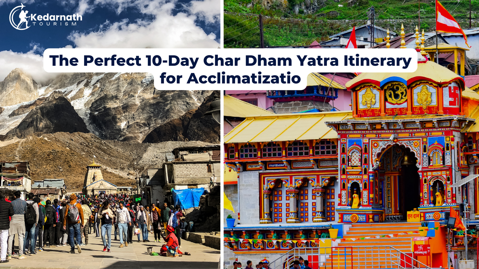
The Recommended 10-Day Acclimatization-Focused Itinerary (from Haridwar)
This itinerary assumes your starting and ending point is Haridwar/Rishikesh. It is designed to keep the daily altitude gain manageable and includes strategic halts at mid-altitudes to allow for crucial acclimatization before you tackle the highest points of the Yatra.
Day 1: Arrival and Grounding in Haridwar/Rishikesh
-
Route: Arrival at your hotel in Haridwar or Rishikesh.
-
Altitude: Haridwar (314m / 1,030 ft) or Rishikesh (372m / 1,220 ft).
-
The Plan: Today is about arrival, recovery, and orientation. Whether you’ve arrived by train, bus, or car, your body has undergone the stress of travel. The primary goal is to rest and hydrate. Check into your hotel, have a wholesome meal, and if you have the energy, take a gentle stroll along the Ghats. In the evening, witness the soul-stirring Ganga Aarti. This is not just a ritual; it’s a moment to mentally and spiritually align yourself with the sacred journey ahead.
-
The “Why” Behind the Stop: Starting at this low altitude allows your body to fully recover from travel fatigue before the ascent begins. Being well-rested and hydrated from Day 1 is fundamental to a successful trip.
-
Health Tip of the Day: Initiate Hydration Protocol. Your goal from this moment until the end of your yatra is to drink 4-5 litres of fluid daily. Buy two large reusable water bottles and make them your constant companions. Start now.
Day 2: The Gentle Ascent to Barkot
-
Route: Haridwar -> Barkot (via Mussoorie & Kempty Falls)
-
Approx. Travel Time: 6-7 hours driving.
-
Starting Altitude: 314m (Haridwar)
-
Ending Altitude: 1,220m (Barkot) / 4,000 ft
-
The Plan: After breakfast, you begin your journey into the mountains. The drive itself is beautiful, taking you through the famed hill station of Mussoorie. You will gain a significant amount of altitude today, but since you are in a vehicle, the exertion is minimal. You will arrive in the small town of Barkot, the base for the Yamunotri leg of the yatra, by late afternoon.
-
The “Why” Behind the Stop: Stopping at Barkot is a strategic acclimatization halt. At 1,220m, it’s high enough to signal to your body that a change is happening, but low enough that it’s highly unlikely to cause any symptoms. It serves as the perfect “stepping stone” before you proceed to the much higher altitude of Yamunotri.
-
Health Tip of the Day: The Acclimatization Walk. After checking into your hotel in Barkot, go for a 30-minute, slow and gentle walk around the town. This simple activity encourages deeper breathing and helps your body begin its adaptation process more actively than if you were to just lie down.
Day 3: Darshan at Yamunotri, the First Dham
-
Route: Barkot -> Janki Chatti (drive) -> Yamunotri (trek) -> Return to Barkot
-
Approx. Travel Time: 2 hours drive (to Janki Chatti) + 5-6 hours trek (round trip).
-
Peak Altitude: 3,293m (Yamunotri) / 10,804 ft
-
The Plan: This is your first test and your first reward. You’ll drive to Janki Chatti, the starting point of the trek. The 6km trek to Yamunotri temple is steep but well-paved. You can choose to walk, hire a pony, or use the palki (palanquin) service. At the temple, take darshan, see the hot springs (Surya Kund), and absorb the divine atmosphere. The key is to descend back to Barkot for the night.
-
The “Why” Behind the Stop: This day perfectly embodies the “Climb High, Sleep Low” principle. You expose your body to a high altitude (3,293m) during the day, which stimulates acclimatization, but you return to the much lower and safer altitude of Barkot (1,220m) to sleep. This greatly reduces the risk of developing symptoms overnight.
-
Health Tip of the Day: Pace, Don’t Race. During the trek, walk at a pace where you can still hold a conversation. If you are gasping for breath, you are moving too fast. Take a short break every 20-30 minutes. Remember, this is a pilgrimage, not a competition.
Day 4: Journey to Uttarkashi, the Land of Gods
-
Route: Barkot -> Uttarkashi
-
Approx. Travel Time: 4-5 hours driving.
-
Starting Altitude: 1,220m (Barkot)
-
Ending Altitude: 1,352m (Uttarkashi) / 4,435 ft
-
The Plan: Today is a relatively relaxed travel day. The drive to Uttarkashi, a holy town situated on the banks of the Bhagirathi river, is scenic. Upon arrival, check in and rest. In the evening, you can visit the renowned Kashi Vishwanath Temple. This is an important day for recovery and continued acclimatization.
-
The “Why” Behind the Stop: Holding at a modest mid-altitude like Uttarkashi consolidates the acclimatization gains from the previous day. Instead of pushing higher immediately, you are giving your body another night to adjust before heading to the second Dham, Gangotri, which is at a similar altitude to Yamunotri.
-
Health Tip of the Day: Eat for the Altitude. Focus on a high-carbohydrate diet. Have dal, rice, roti, and potatoes for dinner. Carbohydrates require less oxygen to metabolize than fats or proteins, making them the ideal fuel source at high altitudes. Avoid heavy, oily, or fried foods.
Day 5: Darshan at Gangotri, the Source of the Ganga
-
Route: Uttarkashi -> Gangotri -> Return to Uttarkashi
-
Approx. Travel Time: 7-8 hours driving (round trip).
-
Peak Altitude: 3,415m (Gangotri) / 11,204 ft
-
The Plan: An early start will take you on a breathtaking drive through the Harshil valley to Gangotri. The journey itself is a highlight. At Gangotri, the atmosphere is electric. Take darshan at the beautiful temple dedicated to Goddess Ganga, walk along the banks of the roaring Bhagirathi, and spend some time in quiet contemplation. You will then drive back to Uttarkashi for the night.
-
The “Why” Behind the Stop: Similar to the Yamunotri plan, you are again applying the “Climb High, Sleep Low” strategy. You spend several hours at the high altitude of Gangotri before returning to the safety of Uttarkashi. This repeated, controlled exposure is excellent for building acclimatization for the even tougher Kedarnath leg of the journey.
-
Health Tip of the Day: Sun Protection. The sun’s UV rays are significantly stronger at high altitudes. Apply a high-SPF sunscreen generously, wear a wide-brimmed hat, and use sunglasses to protect your eyes from the intense glare. Sunburn can contribute to dehydration and fatigue.
Day 6: The Long Drive to Guptkashi/Sonprayag
-
Route: Uttarkashi -> Guptkashi / Sonprayag
-
Approx. Travel Time: 7-8 hours driving.
-
Starting Altitude: 1,352m (Uttarkashi)
-
Ending Altitude: 1,829m (Sonprayag) / 6,000 ft
-
The Plan: This is the longest travel day of the trip, connecting the Gangotri region to the Kedarnath region. The journey is long but essential. You will pass through towns like Tehri and Srinagar. The goal is to reach your base for the Kedarnath trek by evening and get a solid night’s rest.
-
The “Why” Behind the Stop: Sonprayag or Guptkashi are the main bases for the Kedarnath trek. Arriving the day before the trek is the absolute minimum requirement for safety. This halt is your final and most important chance to rest and acclimatize before the most physically demanding part of the Yatra.
-
Health Tip of the Day: Monitor Yourself and Others. You are now consistently at higher altitudes. This is a good time to check in with yourself and your travel companions. Ask questions: “How are you feeling? Do you have a headache? Are you eating well?” Open communication is a key safety tool. If you are feeling any [early symptoms of altitude sickness], report them immediately.
Day 7: The Sacred Trek to Kedarnath Dham
-
Route: Sonprayag -> Gaurikund (shared taxi) -> Kedarnath (trek)
-
Approx. Travel Time: 30 mins drive + 7-8 hours trek.
-
Peak Altitude: 3,583m (Kedarnath) / 11,755 ft
-
The Plan: The day you’ve been preparing for. From Sonprayag, you’ll take a local jeep to Gaurikund, the official start of the 16-18 km trek. The path is steep but rewarding, with stunning views and facilities along the way. Upon reaching Kedarnath, the sight of the temple against the majestic backdrop of the Kedar dome is an experience that will stay with you forever. Attend the evening aarti and spend the night at Kedarnath.
-
The “Why” Behind the Stop: Unlike the previous Dhams, you will spend the night at the highest altitude of your trip. All the previous days of careful acclimatization have prepared your body for this. Sleeping at this height solidifies your adaptation.
-
Health Tip of the Day: The Energy Equation. During the trek, fuel your body with small, frequent snacks. Do not wait for a big lunch. Carry nuts, dates, energy bars, and electrolyte powder to mix with your water. This keeps your energy and blood sugar levels stable throughout the arduous climb. For a detailed guide, see our article on [preparing for the Kedarnath trek].
Day 8: Descent and Recovery
-
Route: Kedarnath -> Gaurikund (trek) -> Sonprayag -> Pipalkoti/Joshimath
-
Approx. Travel Time: 4-5 hours trek + 4-5 hours drive.
-
Starting Altitude: 3,583m (Kedarnath)
-
Ending Altitude: 1,260m (Pipalkoti) / 4,130 ft
-
The Plan: After morning darshan and breakfast, begin your descent back to Gaurikund. While easier on the lungs, the descent is hard on the knees, so take it slow. From Sonprayag, you will drive towards the Badrinath region, stopping for the night at a town like Pipalkoti or Joshimath.
-
The “Why” Behind the Stop: Descending to a lower altitude provides immediate relief to the body. Driving part-way to Badrinath on the same day reduces the travel time for the following day and positions you perfectly for the final leg of the yatra.
-
Health Tip of the Day: Knee Care. Use a walking stick or trekking poles during the descent. They act as a third leg, absorbing a significant amount of impact and protecting your knee joints from the strain of the long downhill walk.
Day 9: Darshan at Badrinath, the Abode of Vishnu
-
Route: Pipalkoti/Joshimath -> Badrinath -> Return to Pipalkoti/Joshimath
-
Approx. Travel Time: 4-5 hours driving (round trip).
-
Peak Altitude: 3,300m (Badrinath) / 10,827 ft
-
The Plan: Today you will visit the final Dham, Badrinath. The vibrant temple town, situated on the banks of the Alaknanda River with the Neelkanth peak in the background, is a sight to behold. Take darshan, visit the Tapt Kund (hot springs), and if time permits, visit the nearby Mana Village, the last village on the Indian border. You will return to a lower altitude for the night.
-
The “Why” Behind the Stop: Your body is now extremely well-acclimatized, so visiting Badrinath will feel significantly easier than the first two Dhams. The now-familiar “Climb High, Sleep Low” approach ensures a comfortable and safe experience.
-
Health Tip of the Day: Replenish and Reflect. Your body has been through a lot. Use this day to eat well and replenish your energy stores. It’s also a time for spiritual reflection on the incredible journey you have undertaken.
Day 10: The Journey Back to Haridwar
-
Route: Pipalkoti/Joshimath -> Haridwar
-
Approx. Travel Time: 9-10 hours driving.
-
The Plan: This is the final day, involving a long drive back to the plains. You will retrace your path through towns like Srinagar and Devprayag, the holy confluence where the Alaknanda and Bhagirathi rivers merge to form the Ganga. You will arrive in Haridwar by late evening, your sacred pilgrimage complete.
-
Health Tip of the Day: Post-Trip Recovery. Even after you reach Haridwar, continue to hydrate well and eat nutritious food. Your body has undergone significant stress, and it needs a day or two of rest to fully recover.
Optional 12-Day Itinerary for a More Relaxed Pace (The Gold Standard)
For those who have the luxury of time, particularly elderly pilgrims or those with pre-existing health concerns, extending the trip to 12 days is the gold standard for safety and enjoyment. You would follow the 10-day plan but insert two extra rest days at key locations:
-
Extra Day in Uttarkashi (Making it a 2-night stay): After your Yamunotri darshan, spend an additional full day resting in Uttarkashi before proceeding to Gangotri. This gives your body a full 48 hours to adapt at a mid-altitude before the next high-altitude exposure.
-
Extra Day in Guptkashi/Sonprayag (Making it a 2-night stay): This is the most beneficial addition. Arrive in Sonprayag on Day 6, and spend all of Day 7 resting, hydrating, and preparing. Embark on the Kedarnath trek on Day 8. This extra day of acclimatization right before the most strenuous part of the Yatra can make a world of difference.
Red Flags: Itinerary Mistakes to Avoid
Be wary of any travel plan that includes these dangerous shortcuts:
-
The 7-Day “Express Yatra”: This is the most common and dangerous mistake. Trying to cover all four Dhams in 7 days involves dangerously long driving hours and zero time for acclimatization. It turns a spiritual journey into a high-risk logistical nightmare. Avoid it at all costs.
-
Night Driving in the Hills: Do not travel on mountain roads after sunset. The risks of landslides, unpredictable road conditions, and driver fatigue are too high. Furthermore, arriving at a high-altitude location late at night, exhausted and dehydrated, is a perfect recipe for getting sick.
-
Ascending with Symptoms: Your itinerary must be flexible. If you or a companion develops symptoms of AMS, the plan must be put on hold. Ascending further with a headache or nausea is a serious gamble. A safe itinerary includes buffer time to allow for rest or descent if needed.
Conclusion: Planning for a Journey, Not a Race
Your Char Dham Yatra itinerary is the sacred thread that weaves together your physical safety and your spiritual goals. By choosing a patient, acclimatization-focused plan, you are making a conscious decision to honor the mountains and your own well-being. This journey is one of the most profound experiences one can have, a pilgrimage through landscapes that are both divinely beautiful and physically demanding.
Treat your schedule with the sanctity it deserves. Plan for a journey, not a race. Allow your body the time it needs to adapt, and you will free your mind and spirit to fully absorb the divine grace that awaits you at each Dham.


