The primary route for pilgrims is approximately 320-345 km by road to the nearest motorable point (Gaurikund/Sonprayag) and then an 18 km trek to the Kedarnath temple. This entire distance is typically covered over two days of travel due to Himalayan road conditions and travel restrictions.
How far is Gangotri to Kedarnath?
The travel from Gangotri Dham to Kedarnath Dham involves a major road journey followed by a mandatory trek. Here are the most definitive, real-world figures for the main Char Dham route:
|
Route Segment |
Gangotri to Kedarnath Distance |
Mode of Travel |
Typical Time (Approx.) |
|
Road Distance (Gangotri Temple to Gaurikund, the road head for Kedarnath) |
Approx. 320 to 345 km |
Car/Bus/Taxi |
10 – 12 hours |
|
Trek Distance (Gaurikund to Kedarnath Temple) |
Approx. 18 km (New Route) |
On Foot/Pony/Palanquin/Helicopter |
6 – 8 hours (Trek) |
|
Total Journey Distance (Gangotri to Kedarnath) |
Approx. 340 to 365 km |
Mixed (Road + Trek) |
2 Days (with night halt near Guptkashi/Sitapur) |
The Gangotri to Kedarnath Distance by Road: A Deep Dive
The journey from the banks of the Bhagirathi River at Gangotri to the Mandakini Valley leading to Kedarnath is a magnificent traverse across the heart of Uttarakhand. This is not a direct route; you must first descend from the Gangotri-Yamunotri region and then ascend into the Rudraprayag-Kedarnath region.
Also Read: How To Go Kedarnath? By Train, Helicopter and Road
The Main Route: The Long Himalayan Weave
The most popular, reliable, and generally fastest route for the Char Dham Yatra is via Uttarkashi, following the course of the National Highway network.
- Gangotri to Uttarkashi: Approx. 100 km (3-4 hours)
- This initial segment descends from the high altitude of Gangotri (around 3,100 meters) to the major town of Uttarkashi.
- Uttarkashi to Rudraprayag (The Mid-Point Hub): Approx. 175 km (6-7 hours)
- This is the longest continuous driving stretch, often involving an overnight halt depending on your starting time from Gangotri. It runs along the picturesque Bhagirathi and Alaknanda rivers.
- Rudraprayag to Gaurikund (Kedarnath Road Head): Approx. 74 km (3-4 hours)
- From Rudraprayag, the route shifts from NH 7 to NH 107, following the Mandakini River upstream, passing through Guptkashi, Phata, and Sonprayag, before reaching Gaurikund.
Total Approximate Road Distance (Gangotri to Gaurikund): 100 km + 175 km + 74 km approx 349 km
Why Does the Kedarnath to Gangotri Distance Vary?
If you search for the distance between Kedarnath to Gangotri, you will find figures ranging from 320 km to 400 km. This discrepancy is due to a few key factors:
- The Final Motorable Point: The actual journey by road often ends at Sonprayag, where private vehicles must park. From here, you take a local shuttle/shared taxi for the final 5 km to Gaurikund (the official start of the trek). Some maps calculate the road distance to Sonprayag (around 345 km), while others calculate it to Gaurikund.
- Alternate Routes: There are minor route variations, such as the Srinagar-Tehri route or the Lambgaon-Tilwara route, which can slightly reduce the Gangotri to Kedarnath road distance by road to around 320 km, but these are often on more challenging single-lane roads and are less frequently used by large tour buses.
- Road Closures/Diversions: Landslides in the Himalayas are a reality. If a major highway is blocked, a significant diversion may be necessary, easily adding 50-100 km to the total distance from Gangotri to Kedarnath by road.
Travel Time: More Than Just Miles
While a distance of 345 km might take 6 hours on plains, in the Himalayas, the actual travel time is dictated by topography, not merely the length.
- The Winding Roads: The journey involves relentless curves and ascents/descents, demanding slow, cautious driving.
- Average Speed: Expect an average speed of only 25-35 km/h on these mountain roads.
- Traffic & Stops: The heavy pilgrim traffic, especially during peak season (May-June), and mandatory security checks/rest stops further extend the travel duration.
Therefore, the Gangotri to Kedarnath distance by car is a solid 10-12 hours of driving time, making an overnight halt (usually in Uttarkashi or Guptkashi) essential for a safe and comfortable trip.
The Gangotri to Kedarnath Trek Distance: A Test of Faith
Once you complete the Gangotri to Gaurikund road distance, the final, most sacred, and physically challenging part of the journey begins: the final trek to the Kedarnath temple.
The Kedarnath to Gangotri Trek Distance Reality
The term “Gangotri to Kedarnath Trek” is generally used for the highly arduous, multi-day, high-altitude expedition that connects the two shrines via passes like Auden’s Col and Khatling Glacier (a total Gangotri to Kedarnath trek distance of 90 – 100 km. However, this is for professional trekkers/mountaineers and is not part of the standard Char Dham Yatra.
For the pilgrim, the “trek” is the final mandatory stretch from Gaurikund to the temple:
- Official Trek Distance: 18 km (via the New Route established after the 2013 floods).
- Starting Point: Gaurikund.
- End Point: Kedarnath Temple.
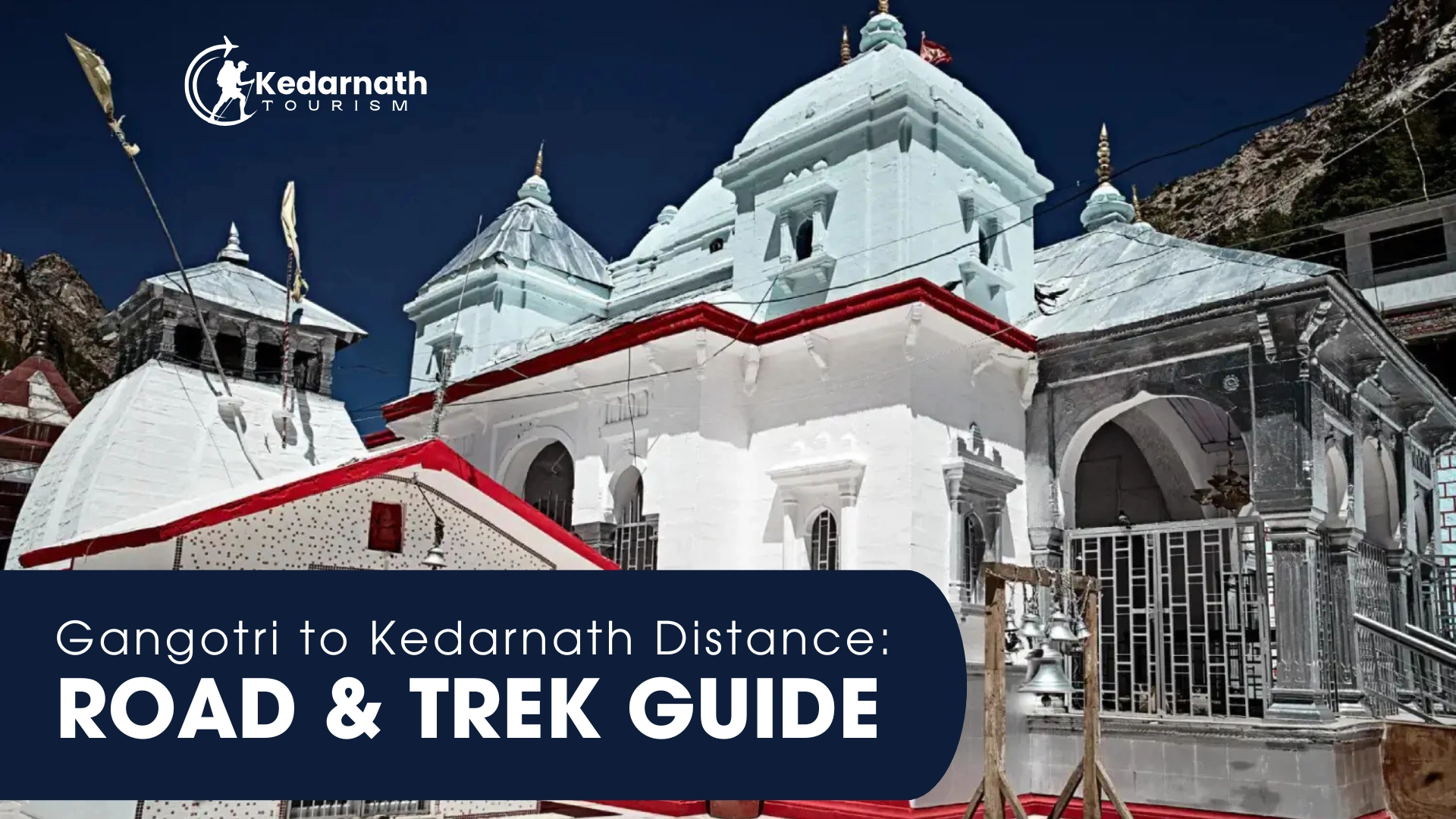
- Altitude Gain: The trek ascends from approximately 1,982 meters (Gaurikund) to 3,583 meters (Kedarnath), making it a significant climb.
Modes of Ascent for the 18 km Trek
The distance from Kedarnath to Gangotri is completed by covering this 18 km trek from the base. Pilgrims have several options to cover this last leg:
|
Mode of Transport |
Details |
Cost & Time Factor |
|
On Foot |
The traditional and most fulfilling way. Requires good physical fitness. |
Time: 6-8 hours for a fit individual. Free, but physically demanding. |
|
Pony/Mule |
Animals for riding are easily available at Gaurikund/Sonprayag. |
Cost: Fixed government rates. Time: 4-6 hours. |
|
Palanquin (Doli) |
A carriage carried by four porters, mainly for elderly or less mobile pilgrims. |
Cost: High fixed government rates. Time: 6-8 hours. |
|
Helicopter |
Flights from various helipads (Phata, Guptkashi, Sitapur) to a helipad near Kedarnath. |
Cost: High. Time: A few minutes flying time. Eliminates the trek. |
Planning the Journey: Gangotri to Kedarnath by Bus and Car
Whether you choose a taxi services in Uttarakhand , or the budget-friendly Gangotri to Kedarnath distance by bus, meticulous planning is key to navigating the distance efficiently and safely.
Travelling by Private Car/Taxi
A private vehicle offers the ultimate flexibility but remember the limitations:
- Convenience: You can stop at will and manage your own pace.
- Road Condition: The roads are well-maintained by Border Roads Organisation (BRO), but they are narrow, winding, and prone to landslides during the monsoon (July-August). Always check the latest Gangotri to Kedarnath distance by road map for closures.
- Parking Constraint: You must park your vehicle at Sonprayag, as the final 5 km to Gaurikund and the subsequent trek are not motorable. You’ll need a local shuttle/shared taxi for the short hop between Sonprayag and Gaurikund.
Travelling by Bus (Gangotri to Kedarnath Distance by Bus)
Bus travel is the most economical way to cover the distance between Gangotri to Kedarnath by road.
- Local State Transport (GMVN/UTTC): Uttarakhand Roadways (UTTC) and GMVN (Garhwal Mandal Vikas Nigam) run regular bus services during the Yatra season.
- Route: The bus route generally follows the main road via Uttarkashi and Rudraprayag to Guptkashi/Sonprayag. You may have to change buses at major hubs like Uttarkashi or Rudraprayag.
- Duration: Bus journeys are typically slower than private taxis, taking 12-14 hours, necessitating a definite overnight break.
Traveler’s Tip: When planning your distance gangotri to kedarnath trip, always book your accommodations for the night halt in advance, especially during the peak season. Guptkashi or Sitapur are highly recommended for the night before the Kedarnath trek.
Also Read: Haridwar to Kedarnath: Distance, Route, Modes & Safety
Essential Night Halts on the Gangotri to Kedarnath Route
Given the driving restrictions (gates open/close at certain times) and the sheer magnitude of the Gangotri to Kedarnath road distance, it is physically and legally impossible to complete the journey in a single day.
A night halt is mandatory for a comfortable and safe yatra.
|
Night Halt Option |
Location & Proximity |
Traveler Profile |
|
Uttarkashi |
Approx. 100 km from Gangotri. Major town with good facilities. |
Ideal for a late start from Gangotri or a leisurely pace. Allows for a full day of driving to Gaurikund on Day 2. |
|
Rudraprayag |
Approx. 275 km from Gangotri. The confluence (Prayag) of the Alaknanda and Mandakini rivers. |
Best if you start early from Gangotri and manage to cover most of the distance. Good mid-way point. |
|
Guptkashi/Sitapur |
Approx. 310-330 km from Gangotri. Closest major accommodation hubs to the trek start point. |
Highly Recommended. Positioning yourself here is perfect. You can start the trek to Kedarnath early on the following morning, avoiding the crowds. |
The decision on where to halt determines how quickly and easily you begin your final ascent to Kedarnath Temple. To minimize the distance between Kedarnath to Gangotri by road on your final day of driving, aim for Guptkashi or Sitapur.
The Auden’s Col Trek: The True Gangotri to Kedarnath Trek Distance
For the adventurous and seasoned trekker, the phrase Gangotri to Kedarnath trek distance refers to a historical, high-altitude route, which is one of the most challenging in the Indian Himalayas.
- Route Overview: This extreme route passes through the Gangotri National Park, crossing the difficult Auden’s Col (a high-altitude mountain pass) and traversing the massive Khatling Glacier, before finally joining the Mandakini Valley route near Kedarnath.
- Distance: Approximately 90 – 100 km of pure high-altitude trekking.
- Duration: Typically takes 10 to 12 days to complete.
- Difficulty: Extremely Difficult. It requires professional mountaineering gear, permits, an experienced guide, and prior high-altitude trekking experience. This is not a pilgrim route.
The take-away is clear: If you are a pilgrim, your journey involves the 345 km road trip plus the 18 km Gaurikund trek. If you are a mountaineer, the Gangotri to Kedarnath trek distance is closer to 100 km over two weeks.
Key Road Segments & Landmarks on the Kedarnath to Gangotri Route
To truly understand the journey and effectively search for real-time information, it helps to break down the route into the major geographical hubs that define the kedarnath to gangotri distance by road:
|
Segment |
Distance (Approx.) |
Significance & River |
|
Gangotri to Uttarkashi |
100 km |
Initial Descent, Bhagirathi River. |
|
Uttarkashi to Tehri Dam |
95 km |
Passes by the massive Tehri Reservoir. |
|
Tehri to Rudraprayag |
80 km |
Alaknanda River valley, major pilgrimage hub. |
|
Rudraprayag to Guptkashi |
40 km |
Enters the Mandakini Valley, focus shifts to Shiva. |
|
Guptkashi to Sonprayag |
30 km |
Main base camp for the Kedarnath trek. |
|
Sonprayag to Gaurikund |
5 km |
Local shuttle route, start of the 18 km trek. |
This detailed breakdown helps in route planning, especially when utilizing distance between kedarnath to gangotri by road apps or hiring a taxi. You can effectively communicate your intended stopovers to the driver or check bus schedules for these specific segments.
Practical Travel Tips for the Gangotri to Kedarnath Journey
Drawing on my years of experience, here are the non-negotiable tips to manage the long distance from gangotri to kedarnath by road and ensure a smooth pilgrimage:
- Start Early, Finish Early: On mountain roads, the golden rule is to start driving by 6 AM. This allows you to reach your night halt by early afternoon, well before the sun sets, when road visibility and safety significantly drop.
- Weather Watch is Mandatory: Rainfall can trigger landslides and cause traffic halts, sometimes for hours. Check the weather forecast for the Rudraprayag and Guptkashi areas before leaving Gangotri.
- Book Your Kedarnath Permit (Registration): Before you even worry about the gangotri to kedarnath distance, ensure you have completed the mandatory biometric registration for the Char Dham Yatra. You cannot proceed past certain checkpoints without it.
- Driver’s Break: Since this is a 10+ hour drive, ensure your driver takes adequate breaks. The journey is strenuous for them. Offer to stop for meals and rest.
- Carry Cash: While major hubs like Uttarkashi and Guptkashi have ATMs, connectivity can be patchy. Carry sufficient cash for local transport (Sonprayag to Gaurikund shuttle, pony hire, small vendor purchases).
- Acclimatisation: Gangotri is already at a high altitude. You will be driving down and then ascending significantly for Kedarnath. Take a day to rest in a low-altitude area like Uttarkashi or Rudraprayag if you feel fatigued.
- Bus Travel Caveat: If using the Gangotri to Kedarnath distance by bus service, remember that bus operations stop by early evening. Plan your break accordingly—don’t try to push past your night halt after 4 PM.
The journey connecting these two pivotal Char Dhams is, by necessity, a slow and deliberate one. It is a time for reflection, for watching the mountains give way to new valleys, and for preparing your heart for the darshan of Lord Shiva in his most spectacular Himalayan abode. Embrace the long drive; it is part of the penance, and a vital aspect of Kedarnath tourism, showcasing the unforgettable beauty of the Devbhoomi.
Frequently Asked Questions (FAQs) for Gangotri to Kedarnath Pilgrims
Q1: Is the Kedarnath to Gangotri Distance the Same as Gangotri to Kedarnath?
A: Yes, the major motorable route is the same, meaning the kedarnath to gangotri distance by road is virtually identical to the gangotri to kedarnath distance by road, approximately 345 km to Gaurikund. The only change would be the specific overnight halts and the direction of the traffic flow.
Q2: Can I cover the entire Gangotri to Kedarnath distance in one day?
A: No, it is highly discouraged and often illegal due to road traffic restrictions. The minimum driving time is 10-12 hours, which is too long to drive safely on mountain roads. Gates often close on certain high-altitude routes in the evening. You must plan for an overnight stay in a town like Rudraprayag, Guptkashi, or Sitapur.
Q3: What is the most convenient way to travel the distance between Gangotri to Kedarnath?
A: The most convenient way is to hire a private taxi/cab for the entire leg of the journey, ensuring you have a dedicated driver. This vehicle will drop you at the Sonprayag parking lot. From there, you use a local shuttle to Gaurikund and then start the trek or take a helicopter.
Q4: Does the road distance include the trek?
A: No. When we cite the Gangotri to Kedarnath road distance of 345 km, it refers to the distance to the last motorable point, Gaurikund/Sonprayag. The final 18 km trek from Gaurikund to Kedarnath Temple is a separate, mandatory journey on foot or via alternative transport like a pony or helicopter.
Q5: Can I travel from Gangotri to Kedarnath by helicopter?
A: You can travel from Gangotri to a helicopter base near Kedarnath. You would still need to cover the Gangotri to Kedarnath distance by road to reach a major helipad (like Guptkashi, Phata, or Sitapur). From one of these helipads, you can take a helicopter directly to the Kedarnath helipad (usually 2-3 km from the temple). This eliminates the 18 km trek.


