 Blog
Blog1. Gangotri National Park
- District: Uttarkashi
- Area: Approximately 2,390 sq km — the largest national park in Uttarakhand
- Year of Establishment: 1989
- Best Time to Visit: May to October
- Nearest Town: Gangotri
- Entry Charges: Roughly INR 250–300 per person for Indian nationals; roughly INR 600 for foreign nationals (subject to change)
- Altitude Range: About 2,497 m to 7,135 m
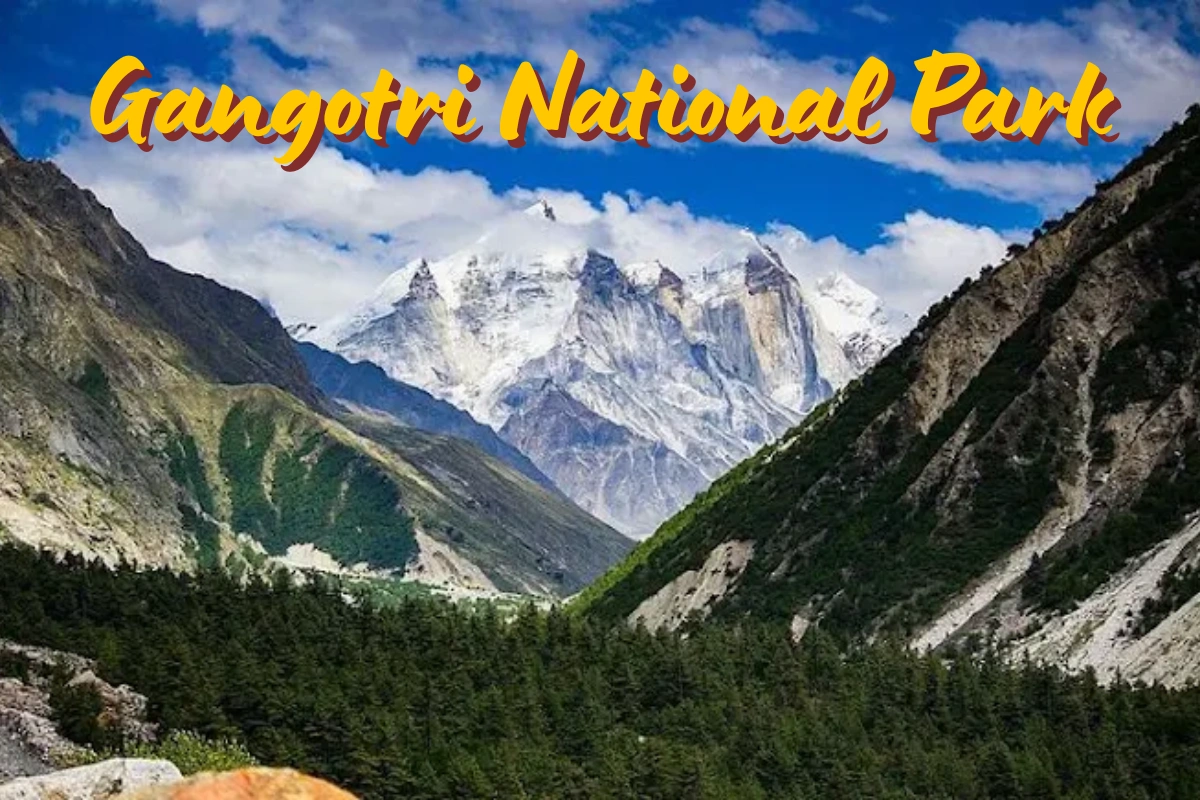
Gangotri National Park is the largest protected area in Uttarakhand, sitting in the upper catchment of the Bhagirathi River in the Garhwal Himalayas. It’s home to the sacred Char Dham site of Gangotri Dham and the Gaumukh Glacier, the actual snout from which the Bhagirathi (and eventually the Ganga) emerges. Major peaks inside the park include Chaukhamba I, II, and III, Satopanth, and the striking Bhagirathi Sisters group. The park’s north-eastern edge runs right along the Indo-Tibetan border, and its southern boundary meets Kedarnath Wildlife Sanctuary — which is why the two protected areas are often discussed together as one continuous high-altitude corridor.
The park is best known for offering one of the last strongholds of the elusive Snow Leopard in its upper reaches, along with a scatter of remote glacial lakes and passes that draw serious mountaineers rather than casual visitors.
How to Reach Gangotri National Park
The park is accessible from two main gateway cities: Dehradun, roughly 206 km away, and Haridwar, roughly 189 km away. Both cities connect by taxi, bus, and rail to the rest of India, and Dehradun’s Jolly Grant Airport is the nearest airport for flight arrivals.
Special Features of Gangotri National Park
- Flora: Ban oak, moru oak, kharsu oak, rhododendron, horse chestnut, deodar, blue pine, spruce, fir, walnut, maple, birch, and alpine species such as aconite and dactyl orchid.
- Fauna: Snow leopard, Himalayan brown bear, Asiatic black bear, musk deer, bharal (blue sheep), and Himalayan tahr.
- Birds: Himalayan monal, koklass pheasant, Himalayan snowcock, Himalayan rubythroat, white-rumped vulture, and rufous-vented tit.
Trekking and Adventure Activities Near Gangotri National Park
- Gaumukh Tapovan Trek — a glacier trek right to the source of the Ganga
- Kedartal Trek — a high-altitude lake trek beneath Mount Thalay Sagar
- Nandanvan and Vasuki Tal Trek
- Dodital Lake Trek
2. Rajaji National Park
- District: Pauri Garhwal, Dehradun, and Haridwar
- Area: Approximately 820 sq km — the second-largest protected area in Uttarakhand
- Year of Establishment: First protected as a sanctuary in 1948; merged into Rajaji National Park in 1983; declared a Tiger Reserve in 2015
- Best Time to Visit: November to June (April to June is best for birdwatching)
- Nearest Town: Dehradun and Haridwar
- Entry Charges: Roughly INR 150–250 per person for Indian nationals; roughly INR 600 for foreign nationals (subject to change)
- Timings: Morning 6 AM–9 AM; Evening 3 PM–6 PM (seasonal)
- Altitude Range: About 247 m to 1,914 m
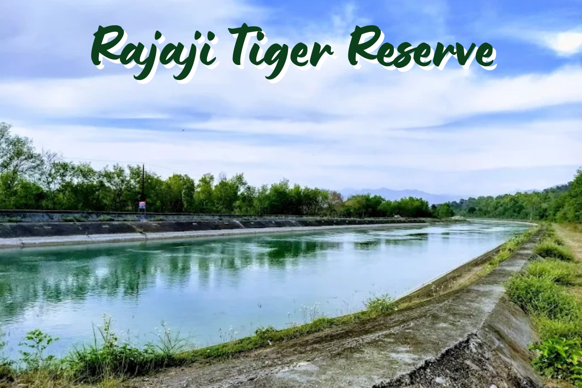
Rajaji National Park is named after C. Rajagopalachari, the freedom fighter and statesman, and was formed by merging three older sanctuaries — Rajaji, Motichur, and Chilla — into a single protected belt across the Shivalik foothills. It sits in the transition zone between the central and western Himalayas, which is exactly why its species count is so high for a lower-altitude park: around 23 species of large mammals and well over 300 recorded bird species. The Ganga River flows through the park, and its forest rest houses at Mundal, Mithawali, Khara, and Gohari are popular bases for birding trips.
How to Reach Rajaji National Park
The park is well connected via Dehradun, which has its own airport, and the nearest railway stations are at Dehradun, Haridwar, and Rishikesh. Travelling by road from Delhi, the common route runs via Meerut, Khatauli, Muzaffarnagar, Roorkee, and Haridwar, reaching the Chilla gate about 8 km from the park boundary.
Special Features of Rajaji National Park
- Flora: Sal, sandan, khair, shisham, semul, rohini, amaltas, palash, arjun, and bel.
- Fauna: Asian elephant, Bengal tiger, leopard, sloth bear, sambar, chital, wild boar, goral, and Indian porcupine — protected under Project Tiger as part of the reserve’s core mandate.
- Birds: Great hornbill, black-necked stork, Pallas’s fish eagle, white-naped woodpecker, scaly thrush, and yellow-billed blue magpie.
Trekking and Adventure Activities in Rajaji National Park
- Jeep and elephant safaris through the Chilla and Motichur ranges
- River rafting on the Ganga near the Chilla barrage
- Birdwatching walks through Jhilmil Jheel
- Easy nature-walk trails suited to families and first-time visitors
3. Nanda Devi National Park
- District: Chamoli
- Area: Approximately 625 sq km
- Year of Establishment: 1982 (initially notified as Sanjay Gandhi National Park)
- Best Time to Visit: May to October
- Nearest Town: Joshimath
- Permit Charges: Roughly INR 50 per person for Indian nationals; roughly INR 150 for foreign nationals (subject to change)
- Altitude Range: About 1,937 m to 7,817 m
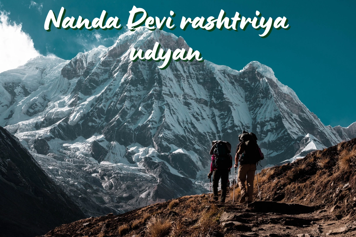
Nanda Devi National Park protects the glacial basin around Nanda Devi Peak (7,817 m) — the second-highest peak in India and the highest located entirely within the country. The Rishi Ganga River drains this basin, and the park is ringed by notable peaks including Dunagiri, Trishul, and Nanda Devi East. It forms the core of the Nanda Devi Biosphere Reserve alongside Valley of Flowers National Park, and together they were declared a UNESCO World Heritage Site in 1988. Access to the inner sanctuary — home to the Uttari and Dakshini Rishi Glaciers — has historically been tightly restricted to protect the ecosystem, while the outer sanctuary around the Trishul and Ramani glaciers sees more regular trekking traffic. This region borders the wider Garhwal pilgrim circuit, and travellers combining a Nanda Devi–area trek with the Badrinath Temple leg of their Char Dham trip often route through the same Joshimath base.
How to Reach Nanda Devi National Park
The standard approach is to drive to Joshimath from Dehradun, Haridwar, or Rishikesh, then continue to Lata Village, about 26 km further, which serves as the trailhead. The nearest railway stations are Haridwar and Rishikesh, while Jolly Grant Airport in Dehradun is the nearest airport.
Special Features of Nanda Devi National Park
- Flora: Deodar cedar, Himalayan cypress, fir, juniper, rhododendron (buransh), Himalayan birch, and high-alpine species such as Brahma kamal and phen kamal.
- Fauna: Snow leopard, Himalayan black bear, brown bear, musk deer, bharal (blue sheep), serow, and Himalayan tahr.
- Birds: Himalayan monal, Himalayan snowcock, golden eagle, Himalayan griffon, and lammergeier (bearded vulture).
Trekking and Adventure Activities Near Nanda Devi National Park
- Kuari Pass Trek and Pangarchulla Peak
- Roopkund Trek — the well-known ‘Skeleton Lake’ trail
- Rudranath Temple Trek
- Ali Bedni Bugyal Trek
4. Jim Corbett National Park
- District: Nainital, Pauri Garhwal, and Almora
- Area: Approximately 521 sq km
- Year of Establishment: 1936 — India’s first national park
- Best Time to Visit: Mid-October to mid-June
- Nearest Town: Ramnagar
- Timings: Morning 6 AM–9 AM; Afternoon 1:30 PM–5 PM (seasonal)
- Permit Charges: Roughly INR 200 per person for Indian nationals; roughly INR 1,000 for foreign nationals (subject to change)
- Altitude Range: About 224 m to 1,825 m
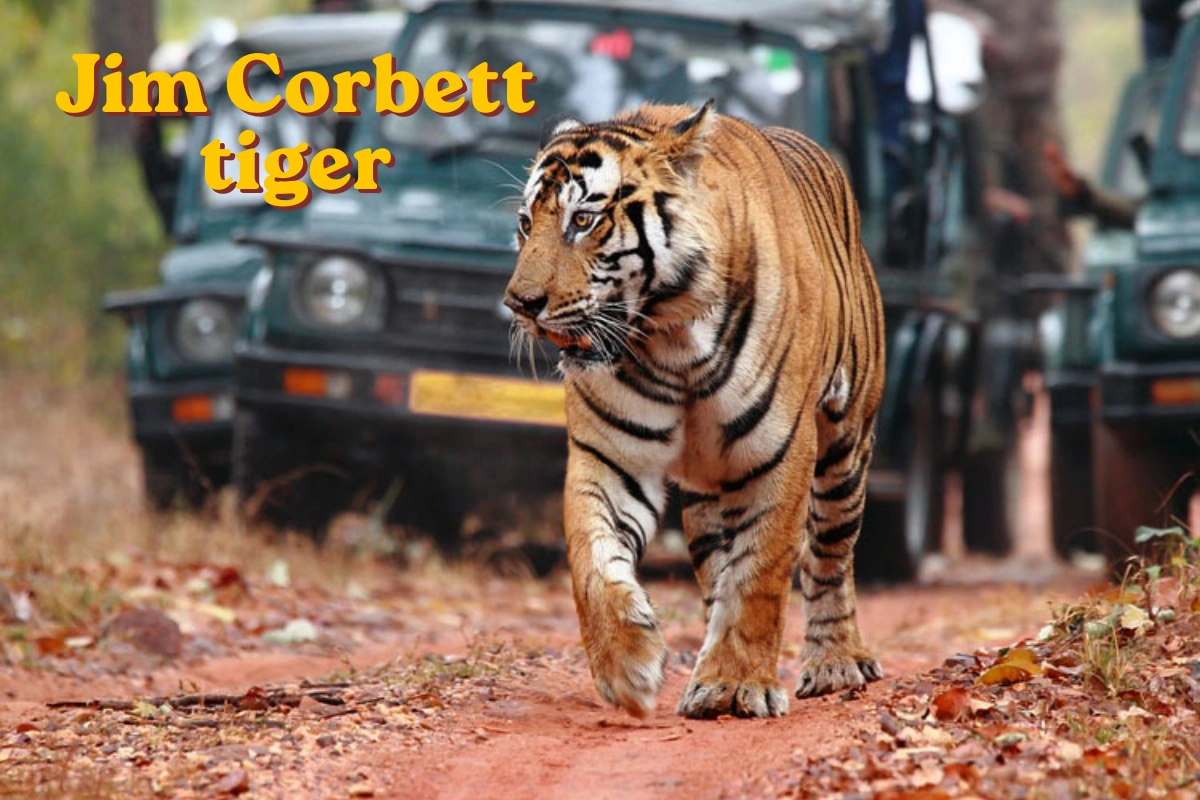
Originally notified as Hailey National Park in 1936, this protected area was renamed Jim Corbett National Park in 1957 in honour of the naturalist and hunter-turned-conservationist whose writing helped shape early Indian wildlife protection. It became the first reserve under Project Tiger in 1973 and remains the crown jewel of Uttarakhand’s wildlife tourism. The park is split into eight zones with separate entry gates — Dhikala, Bijrani, Jhirna, Durgadevi, Sonanadi, Garjiya, Dhela, and Pakhro — and only four of these (Bijrani, Dhela, Garjiya, and Jhirna) stay open through the winter months, with the rest opening for the summer season.
How to Reach Jim Corbett National Park
The park is centred around Ramnagar, which is well connected by both road and rail from Delhi, Moradabad, and Bareilly. The core Dhikala zone is only about 15 km from Ramnagar railway station, making it accessible within half an hour of arrival.
Special Features of Jim Corbett National Park
- Flora: Sal, khair, asan (Indian laurel), kumbhi (wild guava), shisham, jamun, and the silk cotton tree.
- Fauna: Bengal tiger, Asian elephant, leopard, sambar deer, chital, wild boar, langur, and yellow-throated marten.
- Birds: Crested serpent eagle, great hornbill, Indian pitta, grey-headed fishing eagle, and various kingfishers.
Trekking and Adventure Activities Near Jim Corbett National Park
- Jungle safaris across the Dhikala, Bijrani, and Jhirna zones
- River rafting on the Kosi River
- Mukteshwar Trek
- Nainital sightseeing, easily combined as an extension trip
5. Govind Pashu Vihar National Park
- District: Uttarkashi
- Area: Approximately 958 sq km (sanctuary and national park combined)
- Year of Establishment: Notified as a wildlife sanctuary in 1955; upgraded to national park status in 1990
- Best Time to Visit: April to June and September to November
- Nearest Town: Sankri / Dharkadi
- Permit Charges: Roughly INR 200 per person for Indian nationals; roughly INR 1,000 for foreign nationals (subject to change)
- Altitude Range: About 1,300 m to 6,323 m
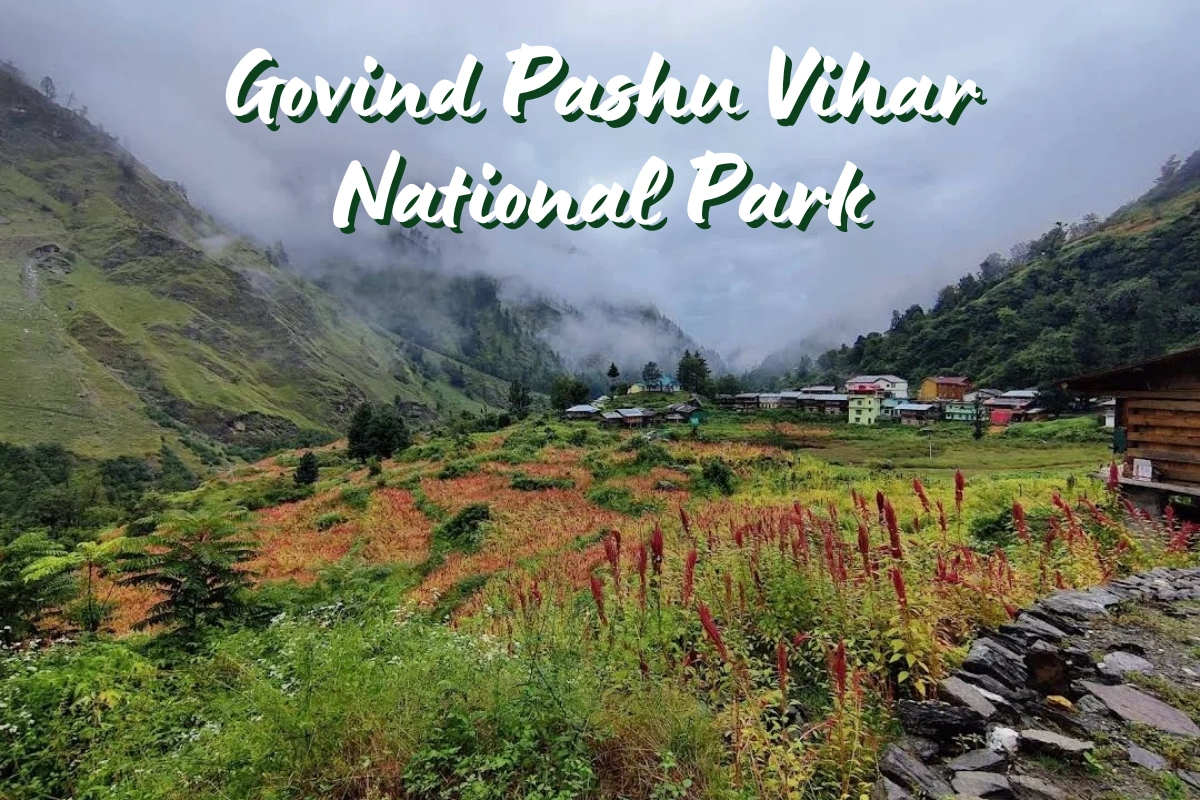
Govind Pashu Vihar National Park is named after Govind Ballabh Pant, the freedom fighter and independent India’s first Home Minister, and sits across the Supin Range in the Tons Forest Division of Uttarkashi district. Two rivers — the Rupin and the Supin — flow through the park and meet at Naitwar to form the Tons River, an important tributary of the Yamuna. In 1990, the upper reaches of the sanctuary were formally notified as a national park under the Snow Leopard Project, chosen specifically for its value as snow leopard habitat. The park also protects one of the last strongholds of the endangered bearded vulture (lammergeier), and its base villages — Osla, Sankri, Taluka, and Gangad — are as much a draw as the wildlife, known for their traditional wood-and-stone architecture and simple mountain life.
Geographical Location of Govind Pashu Vihar National Park
The park lies roughly 225 km north of Dehradun, bordered by Himachal Pradesh to the north and the Tons-Yamuna watershed to the south, forming the upper catchment of the Tons River system.
Special Features of Govind Pashu Vihar National Park
- Flora: Chir pine, deodar cedar, red cedar, oak species, walnut, Himalayan spruce, and rhododendron.
- Fauna: Snow leopard, Asiatic black bear, brown bear, musk deer, blue sheep, Himalayan tahr, and serow.
- Birds: Western tragopan, cheer pheasant, Himalayan monal, koklass pheasant, chukor, and black francolin.
Trekking and Adventure Activities in Govind Pashu Vihar National Park
- Har Ki Dun Trek — one of the most iconic valley treks in India
- Kedarkantha Trek — a popular winter snow trek
- Ruinsara Lake Trek
- Bali Pass Trek and Borasu Pass Trek for experienced trekkers
6. Valley of Flowers National Park
- District: Chamoli
- Area: Approximately 87.5 sq km — one of the smallest national parks in Uttarakhand
- Year of Establishment: 1982
- Best Time to Visit: June to October (park stays open in this window)
- Nearest Town: Joshimath
- Timings: 7 AM to 5 PM
- Permit Charges: Roughly INR 150 per person for Indian nationals for three days; roughly INR 600 for foreign nationals (subject to change)
- Altitude Range: About 2,659 m to 6,410 m
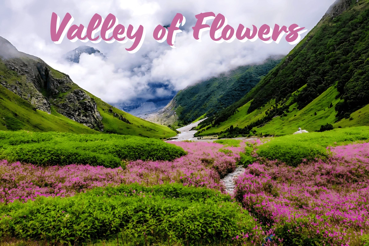
Valley of Flowers National Park is the second core zone of the Nanda Devi Biosphere Reserve and, alongside Nanda Devi National Park, forms a UNESCO World Heritage Site. A trek through the park follows the Pushpawati River past terraced meadows, waterfalls, and alpine wildflower fields that give the valley its name — over 600 recorded plant species bloom here through the monsoon and early autumn. The valley sits in the Bhyunder Valley, with peaks like Nar Parbat, Nilgiri Parbat, Rataban, and Gauri Parbat visible along the ridgelines. It’s also geographically close to Hemkund Sahib, the high-altitude Sikh gurdwara that many trekkers visit on the same trip, and both sit within a short drive of Badrinath — which is why this pocket of Chamoli district often gets combined with the final leg of a Char Dham Yatra itinerary.
Geographical Location of Valley of Flowers National Park
The park sits at the head of the Bhyunder Valley, with Hemkund Valley running parallel to its south, and lies roughly 300 km from Rishikesh near the sacred site of Badrinath. Govindghat village is the last motorable point, and visitors have to trek the remaining distance on foot.
Special Features of Valley of Flowers National Park
- Flora: Blue Himalayan poppy, monkshood (wolfsbane), Himalayan maple, daisy, Himalayan fir, Himalayan white birch, rhododendron, and Himalayan yew.
- Fauna: Himalayan black bear, red fox, grey langur, Himalayan tahr, serow, bharal (blue sheep), and leopard.
Trekking and Adventure Activities Near Valley of Flowers National Park
- Valley of Flowers Trek
- Hemkund Sahib Trek
- Hike to Ghangaria, the base village for both Valley of Flowers and Hemkund Sahib
- Kagbhusandi Lake Trek
Wildlife Sanctuaries in Uttarakhand
Beyond its six national parks, Uttarakhand is officially home to 7 wildlife sanctuaries, 4 conservation reserves, and 1 biosphere reserve — together with the national parks, these cover close to 12% of the state’s total geographical area. The most commonly cited list of wildlife sanctuaries includes:
- Kedarnath Wildlife Sanctuary: Spread across Chamoli and Rudraprayag districts, this is one of the largest sanctuaries in the state and the single most important one for Char Dham travellers, since it directly surrounds Kedarnath Temple and extends across Chopta, Tungnath, and the wider Panch Kedar belt.
- Askot Musk Deer Wildlife Sanctuary: Located in Pithoragarh district in the Kumaon Himalayas, set up specifically to conserve the endangered Himalayan musk deer.
- Binsar Wildlife Sanctuary: In Almora district, established in 1988 at an altitude of around 2,270 m, known for its broad-leaf oak forest and panoramic Himalayan views.
- Sonanadi Wildlife Sanctuary: Contiguous with the Jim Corbett Tiger Reserve, forming part of its buffer zone.
- Govind Pashu Vihar Wildlife Sanctuary: The buffer zone surrounding Govind National Park, managed jointly with the park for conservation purposes.
- Nandhaur Wildlife Sanctuary: Part of the Shivalik ecological corridor in the Terai region, bordering the Corbett landscape.
- Benog Wildlife Sanctuary: Near Mussoorie, a smaller sanctuary popular for short nature walks and birdwatching close to a major hill station.
For Char Dham travellers specifically, Kedarnath Wildlife Sanctuary matters more than any other protected area on this list, since the entire Kedarnath Yatra route — and popular side treks like Chopta, Tungnath Temple, and Chandrashila — sit within its boundaries. The wider Panch Kedar circuit, including the Madhyamaheshwar Temple and the Omkareshwar Temple in Ukhimath, also falls within this same protected landscape, connected through towns like Guptkashi, Ukhimath, and Sonprayag.
Conservation Reserves and Biosphere Reserve in Uttarakhand
Alongside the national parks and sanctuaries, Uttarakhand maintains 4 conservation reserves — smaller, community-linked protected zones that fill ecological gaps between larger parks — and 1 biosphere reserve: the Nanda Devi Biosphere Reserve, which encloses both Nanda Devi National Park and Valley of Flowers National Park as its core zones, with a much larger buffer area around them managed for sustainable use by local communities.
Ramsar Site in Uttarakhand
Uttarakhand’s first (and currently only) Ramsar-designated wetland is the Asan Conservation Reserve, located near Dehradun at the confluence of the Asan and Yamuna rivers. It was declared a Conservation Reserve in 2005 and recognised as a Wetland of International Importance under the Ramsar Convention in 2020. The wetland is a major wintering ground for migratory birds arriving via the Central Asian Flyway, with well over 300 recorded bird species, including several globally threatened ones.
Largest, Smallest, and Oldest: Quick Comparisons
- Largest national park in Uttarakhand: Gangotri National Park, at approximately 2,390 sq km.
- Smallest national park in Uttarakhand: Valley of Flowers National Park, at approximately 87.5 sq km.
- Oldest national park in Uttarakhand: Jim Corbett National Park, established in 1936 as Hailey National Park — also the oldest national park in India.
- Highest-altitude national park: Nanda Devi National Park, reaching up to about 7,817 m at the Nanda Devi summit.
- UNESCO World Heritage Sites among them: Nanda Devi National Park and Valley of Flowers National Park, jointly inscribed in 1988.
Best Time to Visit National Parks in Uttarakhand
- Jim Corbett National Park: Mid-October to mid-June; some zones close entirely during peak monsoon.
- Rajaji National Park: November to June, with April–June being the strongest window for birdwatching.
- Gangotri National Park: May to October, when the high-altitude routes are snow-free.
- Nanda Devi National Park: May to October, matching the trekking season for the outer sanctuary.
- Govind Pashu Vihar National Park: April to June and September to November; monsoon months bring heavy rainfall best avoided.
- Valley of Flowers National Park: June to October, with peak bloom typically in July and August.
Travel Tips for Visiting Uttarakhand’s National Parks
- Book jungle safaris (especially at Jim Corbett) well in advance during peak winter season, as zone-wise permits are limited and fill up fast.
- Carry a valid photo ID for entry and permit checks at every park — Aadhaar, passport, or driving licence are all accepted.
- High-altitude parks like Gangotri, Nanda Devi, and Govind Pashu Vihar require a level of fitness and acclimatisation — don’t treat them like a casual day trip.
- Respect the eco-tourism guidelines; most parks prohibit loud noise, plastic, and off-trail movement to protect fragile alpine ecosystems.
- Check entry timings carefully, since several parks operate strict morning and evening safari windows rather than staying open all day.
- If you’re combining a park visit with a Char Dham leg, build in buffer days — permit processing and road conditions in the high Himalayas can shift your schedule.